| Kimbridge to Brook |
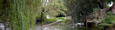
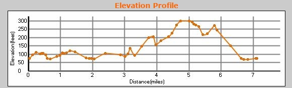
A really lovely, circular walk. The GPX says it's 7.4 miles, but with a couple of missed turns, and hunting for two Geocaches, we'd done just shy of 8 mile by the time we got back to the car. We parked again at Kimbridge, at the Farm Shop, (and Susan had another fresh Test trout for her supper). There are some really nice bits on the Test Way (especially around, and after, Mottisfont), but the best part of this walk is in the higher country, on your way back to Kimbridge. Don't miss the turn off from the Test Way, just before this bridge. Beware the elevation on this walk ... it's flat for the first half, and quite a bit of climb, if you're unfit, on the second. Beware the fast road that you have to cross at Brook, just after you leave the Test Way. Later, if you find yourself walking through the faryard at Manor Farm, you missed the sharp right turn onto the Monarch's Way. When you get to St Mary, Michelmersh, it's all down hill from then on! Park on the red circle below, and either load the GPX file into your GPS, or follow the TW signs. You can scroll the map below simply by moving the mouse with the left-button held down.
|
|
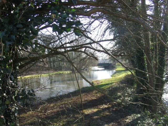
© Copyright Rosemary Oakeshott and licensed for reuse under this Creative Commons Licence
See other pictures of this area here.
To download GPX Files, right-click the link, choose Save Link As ..., and save it to wherever you keep route files.
See the documentation that came with your GPS for information on how to download the route to your GPS.
These are a selection of Ordnance Survey Maps that cover this walk.
Geocaches on route
Mission Impossible #3 of 3 : Wooden Structure (GCKRNY)
There are other caches nearby: see them on Google Maps.